

Movilidad Masiva
English explanation of the ProjectMoving a city
1969 marks the date when reality embraced the utopia of a city with a modern mobility system that would dignify daily transportation for each one of the commuters in need of transiting from the peripheries to the city, or within the enormous labyrinth of streets and neighbourhoods Mexico City is.
Necessity surpassed the then sole system, the Metro (subway). More systems would join to help connect and transport more areas.
In 2005, a more contemporary and faster-expanding system would join the network, the Metrobús (following the steps of Optibús). The system would represent the arrival of the new transportation form, the Bus Rapid Transit, that would substitute the strokes of some of the Metro’s lines that were too disruptive, complex or expensive to build.
The government of the State of Mexico 5 years after created its own BRT system among a national surplus of deployment of these systems (RUTA in Puebla, Tuzobús in Pachuca, to name some). The newly created Mexibús would grow slowly, connecting the peripherals of the city in an arch north of the mountains that divide the State of Mexico and Mexico City.
Clearly, the scope pointed towards the eastern zones of the city (where most of the workers reside, Ecatepec and surrounding areas) which led a free way for a massive project that would connect the western area (Cuautitlán, Tlalnepantla, Naucalpan) with the heart of the city. The Mexico-Queretaro railway would partially resurface, electrified and modernised, including Ferrocarriles Suburbanos into the network of transportation.
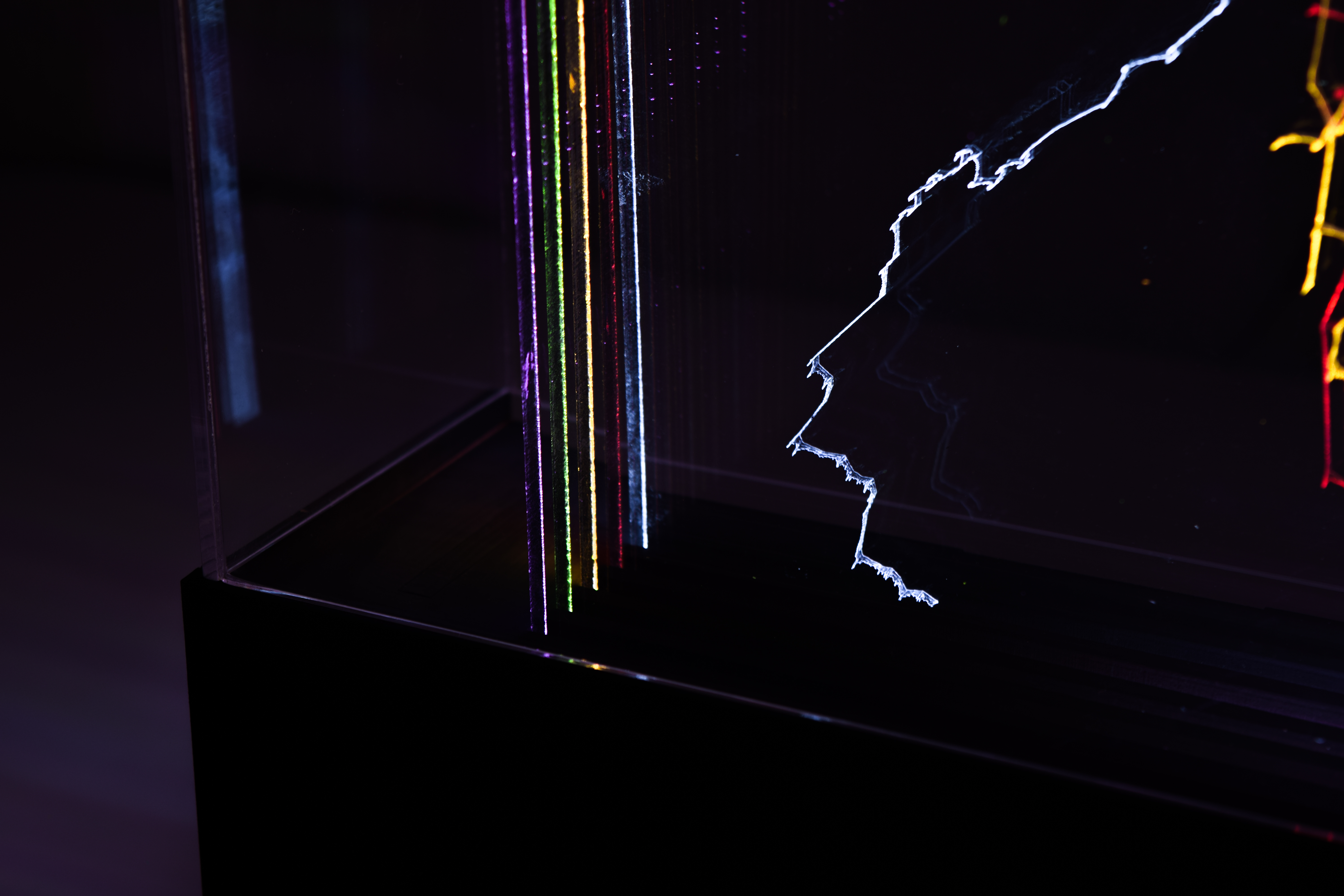
The piece
5 acrylic sheets with specific engravings each represent 4 different systems of massive transportation, which belong to state-run offices and private-run offices. 4 different ways in which a commuter can get throughout the city.
The vectors that compose a city become clear as the typical sense of scale dissolves into nothing. Transparecy surrounds the edge-lit engravings to give life to a palpable, suspended in time and materialised representation of a network that is as immense as the need the city has for it.
Each system has a layer
Base layer: For geographical reference and urban scale, the outline of the political border of Mexico City.
Layer 1 (red): Metrobús
Layer 2 (orange): STC Metro
Layer 3 (green): SITRAMyTEM (Mexibús-Mexicable)
Layer 4 (pink): Ferrocarriles Suburbanos
All systems are represented as a snapshot of the deployment of the network as of 2018.
Metrobús has continued to expand, and Metro is ongoing plans to continue growing.
© Alan Castañeda | © Taller de Arte y Arquitectura Ciudad - 2024